
Største bjerge i Asien. Kan du kan lide højder?
Største bjerge i Asien som rejsetema er ret så alternativt. Hvis du vil på ferie i bjerge og opleve noget andet denne gang, men ikke er sikker på destinationen, kunne du overveje at rejse til Asien, når det nu er muligt igen. Når det kommer til turisme, er Asien et utroligt kontinent. Det skyldes, at Asien tilbyder en imponerende bred vifte af lande at besøge fra Thailand til Kina, men også høje bjerge som i Nepal og Tibet.
Der er nærmest skjulte og ukendte rejsemål i Asien, der har gamle kulturer, en venlig befolkning og betagende landskaber.
Der er hele 48 lande i Asien (se de asiatiske lande Traveltalk dækker) og regioner med en befolkning på 3.823 milliarder, hvilket repræsenterer 60,7% af den samlede verdensbefolkning.
Det asiatiske kontinent er vanskeligt at definere entydigt fra bjergene ned til Sortehavet i vest til de snedækkede marker og bjerge i Sibirien i øst. Fra de nomadiske stepper i Kasakhstan til de hektiske gader i Hanoi er Asien et kontinent, der er så fyldt med modsætninger, eventyr, luksus, fattigdom og extrem kapitalisme og dyb åndelighed. Asien som kontinent har fascineret rejsende i århundreder. Tilmed fødested for de mest kendte verdensreligioner også. Men de fleste af os får et lettere fraværende udtryk, hvis vi bliver bedt om at nævne 5 bjerge i Asien. Ja Mount Everest og Mount Fuji og hvad kommer så derefter? Det er lidt synd, for her er et kæmpe rejse og oplevelses potentiale, hvis man ellers er typen, der søger eventyret og investerer i forberedelse for den helt store oplevelse. Lad os findre vandrestøvlerne frem.

Jade Dragon Snow Mountain
Jade Dragon Snow Mountain ligger i Yulong Naxi autonome amt i Lijiang City, Yunnan-provinsen. Det er det sydligste sneklædte bjerg i Kina. Det er også det største sneklædte bjerg på den nordlige halvkugle. Fra nord til syd er Jade bjerget 35 kilometer lang, 13 kilometer bred fra øst til vest, den dækker et område på 525 kvadratkilometer. Det grænser op til den ene side af Jinsha-floden ved Tiger Leap Gorge, en af de smukkeste vandrestier i hele Kina. Bjerget kan ses fra den antikke by Lijiang, og det er en ganske malerisk udsigt.
Jade Dragon Snow Mountain og de mange legender
Jade Dragon Snow Mountain og nærliggende Haba Snow Mountain har legender knyttet til dem. Ifølge denne legende var der to brødre, der boede ved den lokale flod. En dag kom en ond dæmon og overtog området og dræbte mange lokale. De to brødre kæmpede dæmonen og til sidst kørte den væk. Under slaget blev en af tvillingerne, Haba, dræbt, og den anden bror brugte 13 sværd, der bekæmpede dæmonen. Broren stod vagt over området og holdt de 13 sværd. Han gjorde dette for at forhindre dæmonen i at vende tilbage. Broder Habas bror og hans brors rester blev til sidst Haba Mountain og Jade Dragon Snow Mountain. Broderens 13 sværd blev bjergets 13 toppe.
Jade Dragon Snow Mountain betragtes som et helligt bjerg af Naxi. Ifølge legenden om Naxi-nationalitet er hun inkarnationen af Sanduo, guden for Naxi-etniske gruppe. Bjerget er velsignet med naturlige landskaber i subtropiske, tempererede og kolde zoner, såsom enge, gletschere, kløfter, vandfald, blomster osv. Det er også hjemsted for en række sjældne dyr og planter. I 2007 blev Yulong Snow Mountain Scenic Area godkendt af National Tourism Administration som en klasse 5A National Scenic Site.
Det snedækkede bjerg af Jade Dragon har en højde på 5596 meter, det er kendt som “Natural Alpine Zoo and Botanical Garden” samt “Current Glacier Museum” rig på både dyre- og planteressourcer. Derfor er det er et godt sted at se mange nye dyrearter.
Jade Dragon Snow Mountain er en “rig kilde af naturmedicin”.
De mest populære turistattraktioner i Yulong Snow Mountain Scenic Area inkluderer Glacier Park, der ligger ved Shanzidou Peak med i alt 19 oceaniske gletsjere på toppen, inklusive Hanging Glaciers og Circus Glaciers. Ganhaizi Meadow, som er et naturligt græs, der ligger 2900 meter over havets overflade, Yak Meadow, det smukke og mystiske paradis oversået med blomster og yak om sommeren, White River eller Blue Moon Valley, hvor flodlejet er lavet af kugler hvide og Gran Meadow med en højde på 3.240 meter. Turister kan gå eller leje en hest fra Ganhaizi til Yak Meadow. Derudover er der tre svævebaner i det naturskønne område henholdsvis til Glacier Park, Spruce Meadow og Yak Meadow.
Besøg Kina, rejsetips til enorme Kina
Visit China på vort engelske site
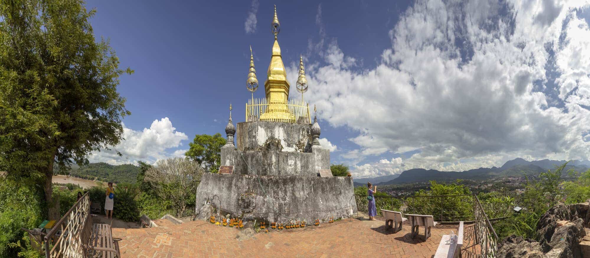
Phousi Hill i Laos, undtagelsen fra højdereglen
Phousi Hill, også kaldet Phousi Mountain, er et lille bjerg eller måske rettere en bakke i centrum af Luang Prabang. Men hvilken “bakke”. Vi tilføjer det her for den rene skønhed og kulturelle betydning. Beliggende i hjertet af byen mellem floderne Mekong og Nam Khan stiger Mount Phousi “majestætisk” til en højde på ja, 100 m. Som det højeste punkt i byen strømmer mange turister til toppen for at få et glimt af den smukke solnedgang over Mekong-floden og nyde det bjergrige landskab, som Luang Prabang giver. Og da UNESCO erkendte, at Luang Prabang er det åndelige hjerte i Laos, er Mount Phousi hjertet i den samme fortryllende by inden for både spiritualitet og geografi.
Phou Si, som betyder “hellig bakke”, er altså kun omkring 100 meter høj, men det vill stadig kvalificere bakken som værende et af de højeste steder i Danmark. Selvom det er en god stigning op til toppen, er det en anstrengelse værd. Fra toppen har du en fantastisk 360-graders udsigt over Luang Prabang, Mekong og Nam Khan-floderne og de skovklædte bjerge.
Phou si, det er et lokalt religiøst sted og et højdepunkt i Luang Prabang. Området er hjemsted for to buddhistiske templer: Wat Tham Phou Si (placeret midt på bakken, bedst tilgængelig via Sakkaline Road-indgangen) og Wat Chom Si, der ligger øverst.
På toppen af Mount Phou Si ligger Wat Chom Si med sin 20 meter høje gyldne stupa. Men indtil da bliver du nødt til at tage et par skridt op. Antallet af trin afhænger af den sti, du vælger at klatre.
Der er en stigning fra Sisavongvang Street, hvor Luang Prabang natmarked finder sted med 328 trin.
Den anden sti med 355 trin er i Thanon Phousi ved siden af Nam Khan-floden. Her kan du finde mange synspunkter, mens du går, såvel som Wat Tham Phou Si med mange Buddha-statuer. Du kan endda se et Buddha-fodaftryk der.
Mount Phousi er det bedste sted i byen at se solnedgangen. Fra toppen af bjerget kan du se en fantastisk udsigt over Luang Prabang og Mekong deltaet. Du kan også nyde en betagende panoramaudsigt over Luang Prabang og den fredelige dal, hvor den ligger. I det fjerne tårner de blå jungle-dækkede bjerge ud over de rolige floder, og hele scenen er helt fantastisk. Dette er grunden til, at Luang Prabang er en af de mest valgte byer i Asien.
I åbne timer, kl. 05:30 M. Ved 6 s. M., Ved alle indgangene til trappen finder du mennesker, der sælger velsignelser for at efterlade i templerne og fugle i bur for at frigive dem øverst. Laotianere mener, at hvis du frigiver en fugl, vil du få held og lykke i fremtiden. Jeg købte fuglene. Ikke kun fordi jeg ville gøre noget for lidt held og lykke, men også fordi burene var så små, og der var to fugle indeni. Bliv fri, små fugle, vær frie.

Mount Kailash i Tibet
Mount Kailash ligger i det vestlige Tibet mellem de majestætiske Himalaya og de imponerende Karakoram bjergkæder. Det betragtes som det mest hellige bjerg i Asien. Det menes at være den fysiske inkarnation af det mytiske Mount Meru, hvis billeder kan findes så langt væk som Angkor Wat i Cambodja og Borabadur i Indonesien. Buddhister og hinduer i Asien mener, at det er centrum for universet. Dens åndelige og religiøse betydning understreges af det faktum, at tilhængere af forskellige religioner betragter det som helligt.
For hinduer er Mount Kailash Lord Shivas opholdssted. For tibetanere er han kendt som Kang Rinpoche. Tilhængere af Bon-Po, den gamle præ-buddhistiske shamanske religion i Tibet, betragter Kailash som sjælen i Tibet. Jains tilbeder Kailash, da Ashtapada-bjerget, på de toppe, som grundlæggeren af jainismen, Rishabanathat, opnåede åndelig oplysning. Kailash-ture gennemføres til åndelige formål såvel som for at nyde de spektakulære bjergkæder og rolige omgivelser. Hinduer, jains og tibetanske buddhister og tilhængere af Bon-Po mener, at omløbet af Kailash-bjerget vil vaske synder væk.
En anden unik facet af Mount Kailash er, at det også er kilden til vandløbene i de 4 helligste floder i det indiske subkontinent, nemlig Sutlej, Karnili (en af Ganges ‘største bifloder), den mægtige Brahmaputra og den gamle Indus-flod. På vej til Mount Kailash krydser du den berømte og åndeligt betydningsfulde Manasarovar-sø, berømt for sit smukke turkisblå vand og den mindre kendte Rakshash Tal-sø. I en højde af 4.510 fod er Lake Manasarovar-sløjfen vanskelig på grund af sumpet land og flere strømovergange.

Turen til dette mystiske bjerg begynder i Kathmandu. Med forberedelse og udstyr klar til turen begynder rejsen med en dagstur til Nylam, der passerer gennem grænsen mellem Nepal og Kina, krydser Zangmu, hvor immigrationsformaliteterne afsluttes, og du ankommer til Nylam for natten. Efter højde akklimatisering i Nylam fortsætter turen gennem landskabet i Tibet og de kinesiske byer Labug-La, Pekut-so og når Saga til næste overnatning. Når du kører gennem Paryang, når du Manasarovar, på otte timer. Du krydser 227 km. I Manasarovar kan du få et glimt af den hellige bjerg Kailash for første gang.
Herfra kører man til Tarchen, som er basislejren for at udføre “den hellige ringvej” eller parikrama på Kailash-bjerget. Herfra er turen til Dehara Puk på 5000 m mere naturskøn, og 15 km stien tager op til 7 timer. Den sidste fase er krydsning af Dolma La-passet ved 18.600 fod, der ligger mellem to dale, der passerer YamaSthal, inden Shiv Sthal nås.
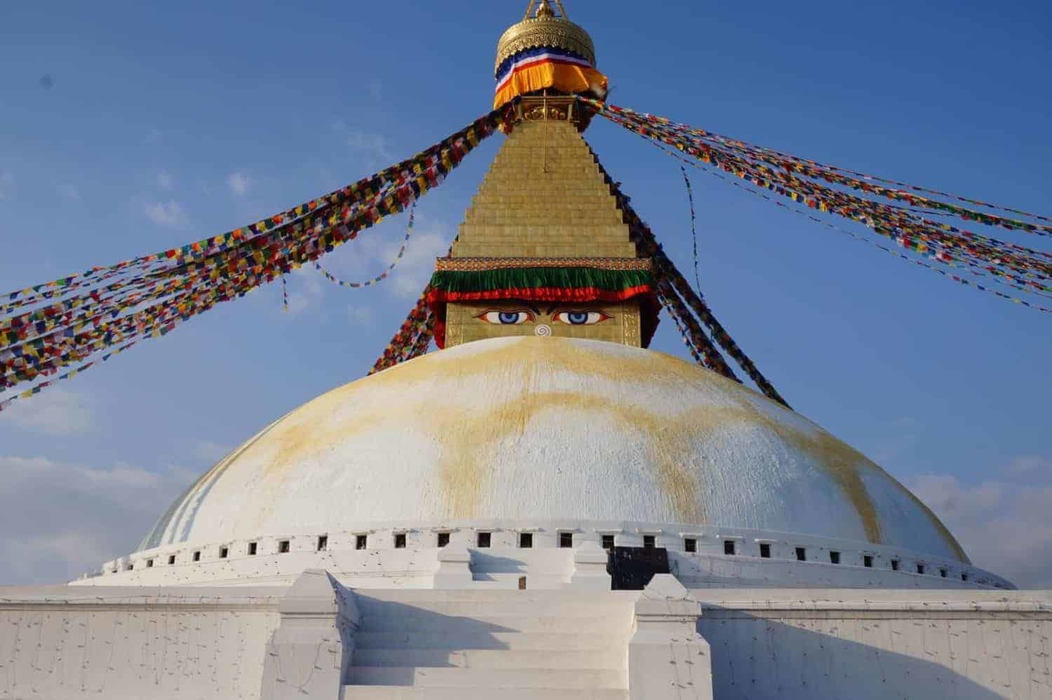
Hele turen i sig selv bliver en måde, direkte elel rindirekte at hylde den mægtige Lord Shiva på. Man bliver så fascineret af skønheden og den majestætiske storhed ved den mægtige Mount Kailash. Man føler sig overvældet og ydmyg, og alt man kan gøre er at forundre sig over naturens guddommelighed og alle natur kræfter, der ligger uden for vores begrænsede menneskelige forståelse .
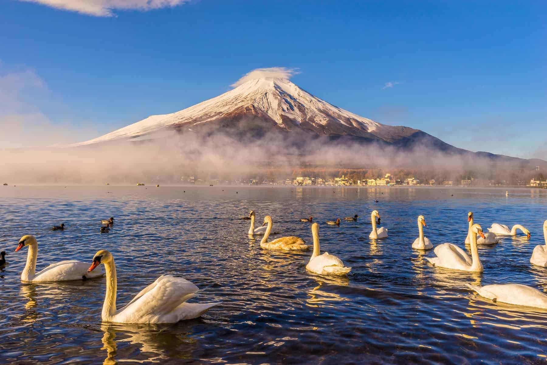
Mount Fuji
Fuji-bjerget stiger mere end 3776 meter over havets overflade. Dette bjerg er dybt rodfæstet i japansk kultur og tro. Indtil idag er Fuji et pilgrimssted for mange japanere.
Fuji er et symbol på Japan, og er dets vigtigste turistattraktion. Fuji betragtes som unik i verden. Fuji er ikke kun en turistattraktion, men dette legendariske bjerg er også genstand for tilbedelse i nogle religioner i Japan. Udover at være en turist- og religiøs interesse er Fuji også stedet for adskillige videnskabelige studier, herunder klimatologi, meteorologi og især i den videnskabelige undersøgelse af vulkaner.
Mennesker over hele verden og ikke kun japanerne har planlagt at bestige Fuji-bjerget mindst en gang i løbet af deres levetid. Millioner flere har rejst til Japan via Mount Fuji-turpakker for at opleve det verdensberømte bjerg.
Bjergvulkanen er det højeste bjerg i landet med det højeste punkt over 12.000 fod højt. Som med mange andre velkendte bjerge i Japan har Mount Fuji sine egne legender, der gennemsyrer japanernes populære historie. Myter, der dyrker både kærlighed og respekt for det snedækkede højdepunkt i Japan.
Omfanget af denne beundring for Fuji-bjerget kan ses i de mange andre mindre “Fuji-san” spredt over hele Japan. Disse er alle mindre bakker eller bjergtoppe opkaldt efter den oprindelige vulkan. Der har også været mange origami-bøger, der har lært ivrige papirmapper, hvordan man opretter et billede af Fuji-bjerget ved hjælp af kunstformen.
For millioner af backpackere og turister har Mount Fuji været et must-see, især for dem, der ønsker at opleve tilstedeværelsen af et af de mest ærede steder i Japan og føle regionens historie. Det siger sig selv, at så mange store digtere, lærde og mænd med stor anseelse har vandret dette bjerg i jagten på oplysning. For mange et indblik i et æterisk rige, hvorfra den japanske race engang udviklede sig i henhold til gammel tradition.
Du kan nyde udsigten over Fuji-bjerget fra komforten af et hurtigkugletog gennem hundreder af miles af teplantager spredt over Shizuoka Prefecture. Du har din madkasse og kold ris tilberedt på bordet, mens du nyder en af de bedste udsigter over det største bjerg i Japan. Hvis du er på vej til Shizuoka via Shin-Yokohama, skal du sidde på højre styrbord sidevinduesæde.
Du kan også nyde Fuji fra luften, hvis du har et vinduesæde. Du sidder der på din indenrigsflyvning til Sapporo, og fra venstre side af dit vindue kan du se de snedækkede toppe i Fuji med din madkasse og kold øl i hånden. Vejret er storslået, og du ved, at du har en god start.

Mera Peak
Mera Peak is the highest of the peaks in Nepal which are defined as ‘trekking peaks’. Mera Peak is a mountain in the Mahalangur district in the Barun sub-district of the Himalayas and is administratively located in the Sagarmatha region of Nepal in the Solukhumbu district of Nepal. With its 6,476 meters it is classified as a trekking peak. It is made up of three main peaks: Mera North, 6,476 meters; Mera Central, 6,461 meters; and Mera South, 6,065 meters, as well as a smaller “trekking peak”, which is visible from the south as a separate peak but is not marked on most maps of the region.
Compared to other peaks in Nepal, Mera Peak is quite adventurous and technically demanding, where you need an experienced and professional guide to achieve the Mera Peak Climbing. This incredible Mera Peak Climbing will offer you the spectacular views of the mountains of more than 8000 meters of the world, such as; Mount Everest, Makalu, Kanchenjunga, Cho-Oyu, Lhotse, and many other impressive peaks. During your trip to Mera Peak Climbing, you must hike through the Hinku Valley following the beautiful dense forest with incredible views of the mountains along the way. Mera Peak Climbing is considered a technical climb and is suitable for climbers in good physical shape who really enjoy adventure and dare to stand on top of the Peak and take in the magnificent views of the Himalayas.
J.O.M Roberts, considered one of the greatest Himalayan explorers in the world, ascended to the top of Mera Peak on May 20, 1953 together with Sen Tenzing following the standard route. There are several routes to the top and all require technical skill. However, the route from the north is suitable for less experienced hikers. The ascent to the west and south is more difficult and is suitable for experienced climbers. You can approach Mera in different ways. The fastest is to leave the airport and join the trail heading east, stopping at Chutang or a neighboring settlement, before crossing Zatrwa La (4610m) and descending to Thuli Kharka and then into the Hinku Valley (3 days or less). A second, much slower approach is to walk south from Lukla and spend several days passing through Poyan, Pangkongma, Nashing Dingma, Chalem Kharka, and Chunbu Kharka before finally descending into the Hinku Valley at Tashing Ongma.
There are three main peaks that can be climbed without much difficulty. The southern summit (6,065 m) is the most accessible with the North Summit (6,476 m), the highest, which can be reached by skirting the Central Summit (6,461 m) to the north and following a snow chain to its summit. Climbing the middle peak requires climbing steep snow and is more technical. Mera North is easy to climb.
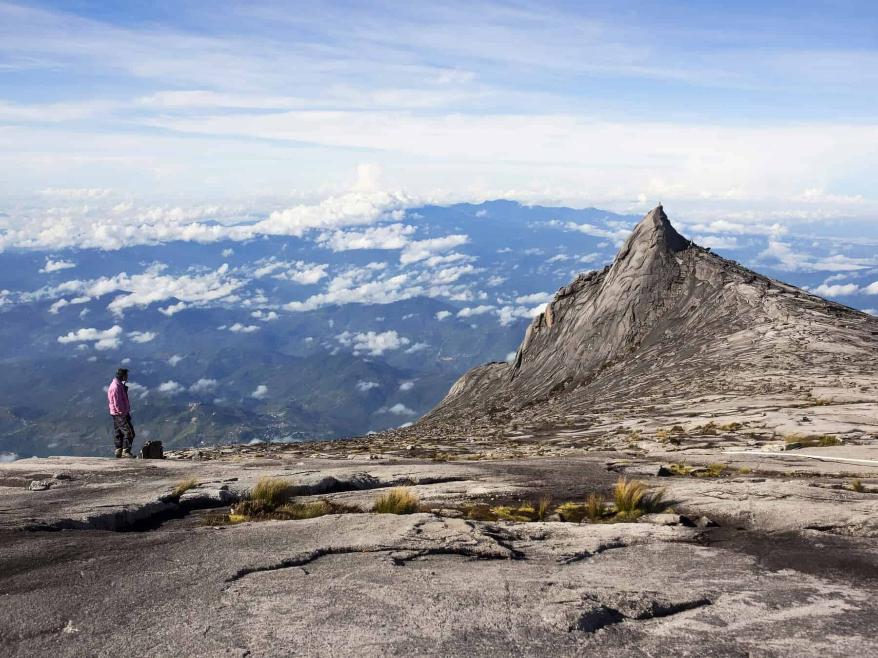
Mount Kinabalu, on top of the world!
Mt Kinabalu
The name Malaysia is derived from a Sanskrit word meaning “land of mountains.” True to its name, Malaysia has more than fifty mountains, of which the highest is Mount Kinabalu. At a height of 13,500 feet, Mount Kinabalu is not only the highest mountain in the country and also the fourth highest in Southeast Asia, but it is also home to a tremendous botanical and biological species that is rare to find anywhere else in the world. . All of this makes climbing Mount Kinabalu one of the most rewarding activities that both locals and tourists shouldn’t miss in Sabah.
The first person to dare to climb Mount Kinabalu was a British colonial officer. Sir Hugo Low made this trek to the top in 1851. Now men and women come to climb the mountain every year, trying to achieve the fastest times and break the record.
An interesting aspect of the Borneo Kinabalu mountain is that, it is considered a sacred place by the locals as they believe that the mountain is a resting place for the spirits of their ancestors who inhabit the top of the mountain. In fact, it is heard that before a chicken was sacrificed on the top of the mountain each time a climb was made, but today this ceremony is performed only once a year when seven chickens are sacrificed for the spirits.
The walk has 2 main starting points:
Timpohon Gate – at an altitude of 1,866 meters located 5 km from the park entrance. The place is also known as “Pondok Timpohon”, which means “Refuge of Timpohon”, due to the large wooden refuge that was built here. The place is quiet and offers a spectacular view. The place has a control point for climbers, where they can present their permits to the stationed ranger. It also has a shop, which offers sandwiches and snacks.
Mesilau Nature Resort – A tourist resort built in 1998, which is a great lodging place for ecotourists. It is located 30 minutes from Kinabalu Park and 2000 meters above sea level. This is also a quiet place and its meeting room is ideal for motivational trainings, seminars, meetings and small group retreats.
If you are a beginner, Low’s Peak is not too difficult to climb if you are in good physical shape.
Mount Kinabalu is known worldwide for its biological and botanical diversity. There are some species that are found only in the national park and nowhere else in the world. The park has more flora than the entire African continent and around 50 of these species are found nowhere else in the world. The park is the richest place for insectivorous plants called pitcher plants that feed on insects. Then there is the parasitic plant called Rafflesia which has the largest single flower in the world. Research suggests that the mountain and the park are home to 5,000 to 6,000 plant species, which is more than the number of species in all of Europe and America combined.

Mount Huashan, now China´s candidate to biggest mountains in Asia
It has often been suggested that the most dangerous mountain trekking destination in the world is the trek to Mount Huashan in China. It begins with Heavenly Stairs, a long, steep, narrow series of concrete steps that are tolerable at best. However, only the bravest hiker would venture across Canglong Ridge, also known as Black Dragon Ridge, which is even steeper and narrower, with very steep drops to the left and right.
Mount Huashan is located in Huayin, Shaanxi, about 120 km east of Xi’an. It is far from the ocean and belongs to the continental monsoon climate of the warm temperate zone. Because the mountain is steep and high, the temperature drops 0.44 ℃ – 0.5 ℃ for every 100 meters of elevation. Its annual rainfall is 1030 mm and is mainly concentrated in June, July and August. The mountain is known for its steep cliffs and deep ravines. It is known as “the steepest mountain under the sky” and is probably the most dangerous mountain in the world frequented by hikers.
There are five peaks that make up the mountain: Cloud Terrace Peak (North Peak, 1614m), Jade Maiden Peak (Middle Peak, 2042m), Sunrise Peak (East Peak, 2100m), Lotus Peak (West Peak, 2083m) and Landing Peak Wild Goose (South Peak, 2155m).
It usually takes 1-2 days to complete a tour of Huashan. If you only have one day, you will need to take a cable car from East Gate to North Peak. Then walk about 2 hours to East Peak and another 1.5 hours to South Peak. On the way you will pass the famous and dangerous Plank Road. After that, keep walking for about 40 minutes and you will reach West Peak, where you can take a cable car to the foot of Huashan.
The Jade Spring Temple at the foot of the mountain is the starting point. The East Peak observation deck with a height of 6,857 feet is usually the destination for tourists to climb the Huashan trail at night, which is the best place to see the sunrise. You will pass North Peak at an elevation of 5295 feet on the way, where you can take a good rest to recharge. When you reach North Peak successfully, it means that you have completed more than half of the Mt Huashan hiking trail. And it usually takes another 1.5 hours from North Peak to reach your climbing destination – the sun viewing platform at East Peak. Then you can rest and wait for the beautiful sunrise view.
Hua Shan has a large number of religious sites: Taoist temples, pavilions and engraved scriptures are scattered all over the mountain.
The mountain is considered one of the five sacred mountains of China and is one of the most popular tourist attractions and pilgrimage places for Chinese.

Mount Apo, a Philippine contender to biggest mountains in Asia
Mount Apo, which means “grandfather” or “teacher” in the local dialect, is the highest mountain and volcano in the Philippines.
It is located between the city of Davao and Davao del Sur, Region XI and the province of Cotabato, Region XII in Mindanao. It also has a land area of 54,974.87 hectares. It is the highest mountain in the Philippines with an altitude of 2,954 meters. Due to such elevation, it is one of the most popular destinations for mountaineering in the country. Mount Apo was declared a national park on May 9, 1936. Decades later, it became a protected area in the category of natural park.
Mount Apo is one of the must-see and experience of every adventure tourist or backpacker visiting the country, especially in the Davao province where it is located, it is the largest city in the Philippines in terms of land area and the largest city populated country outside of Metro Manila.
Mount Apo vertical climb is the ultimate fitness challenge for Filipinos and travelers in great shape. The terrain along the mountain is full of lush forests and more wildlife than volcanic rock. Mount Apo can be divided into 3 different types of forest. From the beginning of the ascent, climbers can experience the beauty and challenges of the lowland rainforests. Although flashy and exuberant, the beginning of the ascent is considered a kind of natural obstacle course. Hikers should watch their steps for tree roots and slippery rocks, maybe even the occasional snake. As you reach the mid-mountain forests of Mount Apo, the lush terrain will narrow slightly with fewer trees and animals around and more rocks and slopes to tackle.
The physical fitness and determination of the hiker is put to the test much more as they reach higher altitudes. As the hiker approaches the peaks, the vegetation can still be seen but it is much less lush and thick compared to the lower altitudes and very few animals are found due to lack of oxygen. The climb becomes somewhat easier due to fewer obstacles, but physical strength is a must to tackle the very steep sections to reach the peaks of Mount Apo.

Mount Khüiten, rather unknown candidate to the list of biggest mountains in Asia
In Mongolia, one is quickly carried away by the endless green steppes, the warmth of Kazakh nomads, and the rolling landscapes of the Altai Mountains. Mount Khüiten, straddling the corners of three countries (Russia, China and Mongolia), attracts adventurers.
Mount Khuiten is part of a mountain range called Tavan Bogd, which means “five saints, and each of the names of the peaks represents simple meanings: Nairamdal – friendship; Malchin – shepherd; Burgd – eagle; Olgii – cradle; and Khuiten. – cold.
The Altai Range encompasses parts of Mongolia, China, Kazakhstan, and Russia, and is home to an area that has remained relatively unchanged since the last ice age. With a few exceptions, the fauna has remained the same. Ibex, Arguli (sheep) and the endangered snow leopard can be found in Altai. The region also has a large number of archaeological sites, and many examples of prehistoric man have been discovered in the surrounding areas.
Mount Khuiten is one of the most remote and unspoiled regions in the world. So remote that it takes a couple of flights, a 400 km trip from the nearest airport, and a 17 km hike to reach the Mount Khuiten base camp; only then does the climb really begin. A challenging climb over varied terrain: endless green lands to thick snow and arid rock faces.
Another mountain near the Khuiten mountain that you can reach are Mount Malchin (4050 m) and Mount Naraimdal (4003 m). They are commonly raised with Khüiten. Malchin is located on the border between Mongolia and Russia, offers exceptional views of Khüiten and is a great acclimatization hike from base camp. It is commonly traveled by groups of hikers, and there is a use trail most of the way to the top. Naraimdal (Friendship Peak) can be easily climbed from the Khüiten High Camp, and is especially interesting as it is the point of the triple border of Russia, Mongolia and China.

Mount Everest is surely one of the biggest mountains in Asia
Mount Everest is the highest mountain in the world with an elevation of 8844.43 meters. Thousands of people make their expedition from far away to explore the splendid sights of “The Third Pole.” Mount Everest is located on the border of China and Nepal. The south side is in Nepal, very steep and difficult for regular tourists to visit. Meanwhile, the north side is in Tibet, and gradually ascends to the Everest Base Camp which is located at an altitude of 5,200 m. The infrastructure on the north of Mount Everest is much better than on the south side.
Local names for Mount Everest include Chomolungma in Tibetan (meaning “Mother Goddess of the world”) and Sagarmatha (meaning “Mother of the ocean”) in Sanskrit.
The Everest region of Nepal is more than climbing and hiking, it is a life changing experience and some see it as a close journey to reaching Nirvana. Located in the northeastern province of Nepal, this region is in a world of its own with vast glaciers, ice falls, the tallest mountains, deep valleys, slums and resilient people who challenge the harshest conditions that nature presents in the air. high-rise.
Mount Everest attracts experienced mountaineers, as well as less experienced climbers who often recruit guides known as Sherpas. Climbing more than 8,000 feet is not an easy task.
There are 2 main routes that are used to ascend to the top of Mount Everest. The most popular is the Southeast route. The base camp for this route is located on the mountain side of Nepal; Then climbers must ascend the Khumbu Icefall, which is considered by many to be the most dangerous part of the climb. Then they must walk through the Western Cmw which leads to the face of the Lhotse, a huge and steep slope where a mistake will very often cost you your life. Climbers are now approaching the death zone and heading to the SE ridge, once past the 8,000 meter mark, they must overcome the famous Hillary Step, which is a huge rock wall that is terribly exposed. All that is left is the summit ridge which is relatively easy and then sets the top of Everest, the roof of the world.
Mount Fansipan
Mount Fansipan is the highest mountain in Vietnam and the Indochinese peninsula, located in the Hoang Lien Son mountain range. At 3,143 m (10,312 ft) it is a real mountain, but it can be climbed without any specialized equipment, guides or porters. Located near the former French colonial station of Sapa, Fansipan is part of Vietnam’s Hoang Lien Son mountain range, which is essentially the most southeastern extension of the same continental collision that formed the Himalayas.
https://youtu.be/-_u0S3_i7CA
There are several trails to reach the top of Mount Fansipan, romantically known as the ‘Roof of Indochina’; the ascent of Mount Fansipan can be done comfortably in one day if you are in reasonably good physical condition.
However, only one is easy enough and equally safe enough to follow independently, without a guide. This is the trail that begins at the entrance to Thác Tình Yêu (Waterfall of Love), 15 km west of Sapa on the QL4D road. Known as the Tram Ton Pass trail, it is fairly easy to follow and, despite local views to the contrary, can be comfortably climbed in one day, without a guide.
The scenery is amazing remember to bring a camera. In the mountains having a raincoat is not a bad idea, especially at night. The trails around Sapa are a lot of fun. You will have the opportunity to pass through some minority towns if you have time to explore.
Sun World Fansipan cable cars hold a Guinness World Record and the trip to the top is a highlight of many travelers’ time in Sapa. The cable cars run from 7:30 am to 5:30 pm every day, and each can hold up to 35 passengers.
Before reaching the top of Mt. Fansipan, you will arrive in a peaceful complex of gardens, with stone paths, ancient azaleas and 18 skillfully sculpted bronze statues. These sculptures lead to a 20-meter heavenly Buddha statue perched on the side of the mountain, the largest in the country. The surrounding gardens and pagodas provide a peaceful setting to pause and breathe in the fresh air.
A series of stairs or a funicular will take you to the final stretch to the top of Mt. Fansipan. From here, you will have the rewarding and incredible view of cloud-covered peaks stretching to the horizon. The highest point is a favorite spot for selfies, but you can walk the entire platform for 360-degree views. Cloud formations at the top of Mt. Fansipan changes every few seconds, revealing new shapes and scenes as earth meets heaven.
Mount Bromo, East Java, Indonesia ends our list of biggest mountains in Asia
The Tengger caldera, a volcanic crater with a size of around 10 km stretches in the distance surrounded by the Laut Pasir (Sea of Sand) of high volcanic sand. The total area covers no less than 5,250 hectares. But at this time of day only the sloping edges are visible. A white haze seems to hang over it, covering most of the huge crater.
In the center, five peaks protrude from the haze, namely the Bromo, Batok, Widodaren, Kursi and Giri mountains. In the background, is Mount Semeru (3.6976 meters above sea level), the highest peak on the entire island of Java, which stands as an anchor for all the natural splendor seen at this point. Meanwhile, volcanic smoke can be seen billowing continuously from Bromo, with occasional mushroom clouds rising from the symmetrical peak of Semeru, adding to the spectacular views. A greater sense of life.
The name of the mountain itself comes from the word Brahma (one of the Hindu gods). Along with Semeru, Batok, and the Tengger Mountains, these attractions enter the Bromo Tengger Semeru National Park area. The puffs of white smoke from the volcanic crater, the beautiful sunrise and a sea of sand surrounded by a caldera are the main attractions here.
You can also see the Kasada Ceremony when it comes at the right time. The ceremony that the Tengger people perform generally begins at midnight until dawn each full moon. The Kesodo Ceremony is a ceremony to ask for an abundant harvest or to request reinforcements and cures of various diseases, that is, offering offerings and throwing them into the crater of Mount Bromo.
Chasing Sunrise is the top destination for visitors and this one should not be missed. Pananjakan Hill 1 and Pananjakan Hill 2 are the best and favorite places for visitors to enjoy this panorama. A large viewpoint with a large fenced terrace, to help the tourist to capture the beauty of the panorama safely and freely.